Visit to Cliffs of Baltard & Castle/Napoleonic Signal Tower
15 August, 2pm - 4pm
- Google map link: https://maps.app.goo.gl/tHZV69SyP1mo9hPR8
- Baltard, Doonbeg, Kilrush, Co. Clare.
- V15PR68
- Co. Clare
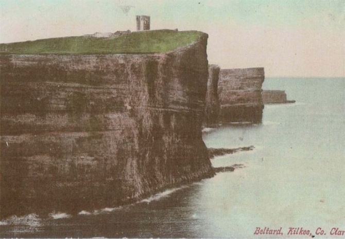
Baltard is a peninsula, surrounded by the Atlantic Ocean and has some of the most dramatic cliffs and coastline in West Clare; at Baltard Bay (locally known as Beal na Lice), the Hubawns and Donegal Point.
The Annals of the Four Masters record a cataclysmic earthquake and massive tidal wave in West Clare in the year 799 AD, which split the land between the Cliffs of Moher and Cliffs of Baltard taking over 1,000 lives.The highest point along the Cliffs of Baltard is 260 feet. This majestic setting has panoramic over sea and land.
These cliffs have been a popular destination for jaunting cars from Kilkee in Victorian times, as recorded in the Lawrence Photograph Collection. Our Heritage Week tour will include a display of the photos of Baltard.
This signal tower built between 1804-1806 as part of a ring of 81 towers around Ireland. The British Government was concerned about a possible invasion by Napoleon. The sites were constructed as coastal defences commissioned in response to the repeated attempts by French forces to invade Ireland that occurred in 1796 and 1798. This threat dissipated after Napolean’s defeat at the battle of Waterloo in 1815. The other five towers in Clare were located at Loop Head, Knocknagaroon, Mutton Island and Hags Head.
The castle was demolished in 1957, and its stones were reused in farm buildings. Today it is possible to see the site of the tower and its outer walls.
This is a special one off event with the kind permission of the private land owners.
Please follow fenced walkway and guides. Suitable shoes and clothing are required.
Dogs are not permited.
No toilet facilities are available.