Digital Cliffs: Exploring the Archaeology of Loop Head in 3D
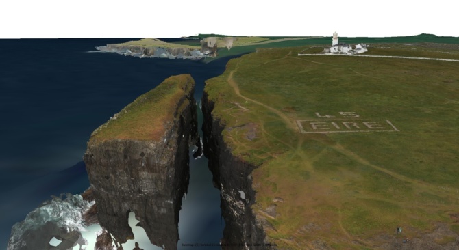
Organised by Clare County Council and supported by Loop Head Together and Loop Head Tourism, this presentation invites you on a virtual tour of the dramatic coastline of Loop Head, County Clare, through an interactive 3D model created using high-resolution remote sensing technologies. In 2024, Clare County Council commissioned SurveyLabs Ireland, the Centre for Robotics & Intelligent Systems (CRIS), School of Engineering, University of Limerick, to fly drones across Loop Head to collect LiDAR data and photography. Dr Bonsall and his colleagues at AMS have analysed the data to explore Loop Head from the land and from the sea. The result is a detailed digital record of archaeological monuments, holy wells, and striking geological features—many of which are at risk from coastal erosion and climate change.
Combining archaeology, folklore, and community knowledge, the project offers new insights into the cultural landscape of this unique peninsula. Using a live model viewer, Dr Bonsall will explore monuments and landscape features in 3D. This pilot project supports heritage preservation and climate adaptation by identifying monuments at risk, highlighting newly discovered features, and creating a baseline for future monitoring.
Join us as we explore how digital tools are being brought together to protect Loop Head’s vulnerable heritage and inspire community-led stewardship for future generations.